Basic Information
Observation Details
Observation Date:
January 10, 2023Submitted:
January 11, 2023Observer:
SAC - Davis, VandenBosZone or Region:
Banner SummitLocation:
Copper Mountain - North Side (W-N-E, 6,600-8,900')Signs of Unstable Snow
Recent Avalanches?
YesCracking?
IsolatedCollapsing?
IsolatedSnow Stability
Stability Rating:
FairConfidence in Rating:
ModerateStability Trend:
SteadyBottom Line
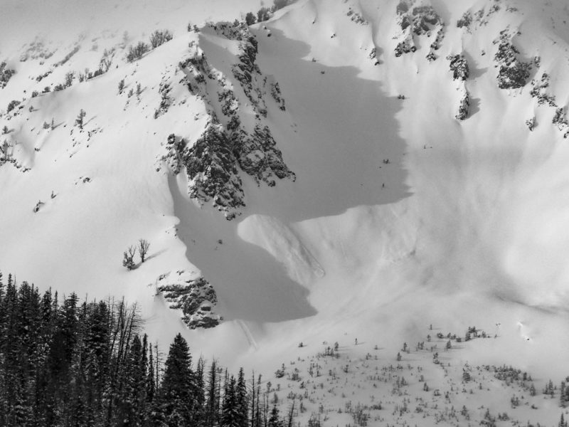
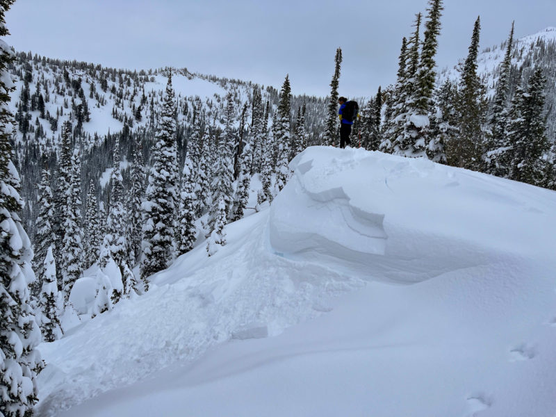
We found a touchy layer of surface hoar buried under ~1 foot of snow. The layer was responsible for one small natural avalanche, cracking in drifts, and poor snowpack test scores.
Media/Attachments
Advanced Information
Weather Summary
Cloud Cover:
Mostly CloudyTemperature:
Low 20sFWind:
Light , ENew/Recent Snowfall:
HST since (1/5) = 40 cmMuch of the mountains N of Galena Summit saw a healthy dose of sun in the morning hours. Clouds moved in midday. Very light snowfall began at Banner Summit around 4PM. Less than an inch had fallen by dark. Wind blew light from the E and SE.
Avalanche Observations
| # | Date | Location | Size | Type | Bed Sfc | Depth | Trigger | Photos | Details |
|---|---|---|---|---|---|---|---|---|---|
| 1 |
Jan 9, 2023 (+/- 1 day) |
Near McDonald Peak NE 9500ft |
D2 | N-Natural |
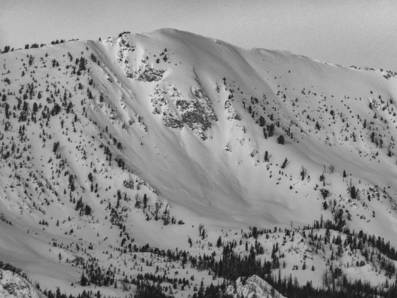
|
Report | |||
| 1 |
Jan 9, 2023 (+/- 1 day) |
Near Decker Pk E 10000ft |
D2 | N-Natural |
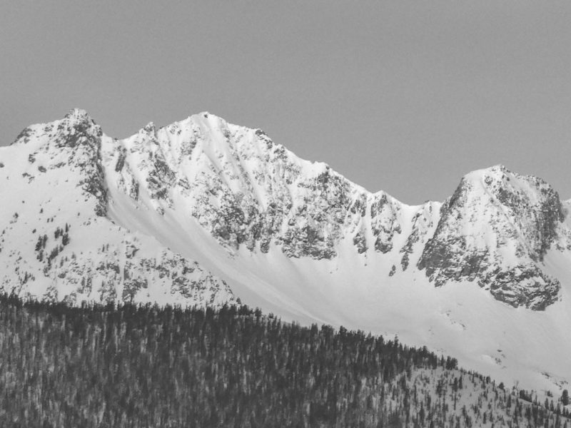
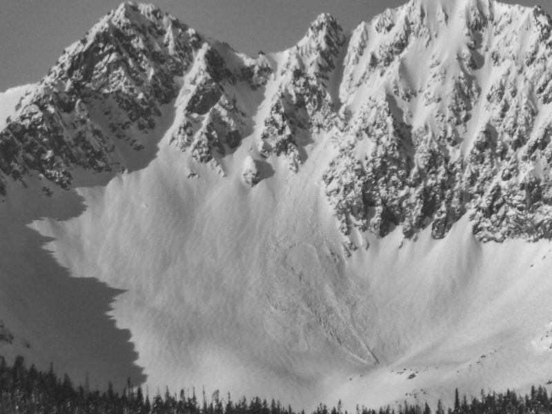
|
Report | |||
| 1 |
Jan 9, 2023 (+/- 1 day) |
Eureka Pk E 10100ft |
D2 | N-Natural |
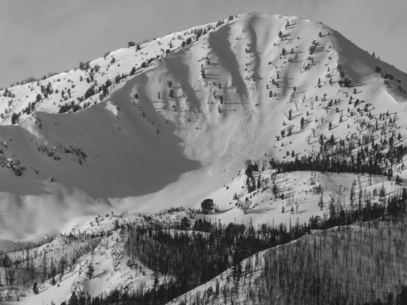
|
Report |
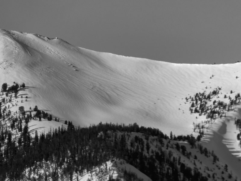
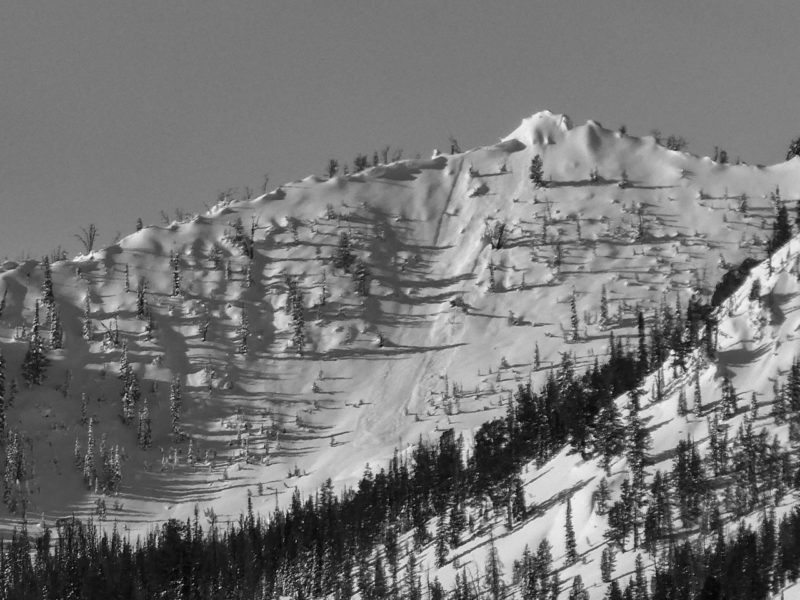
We had good visibility from Decker Pk south to the Headwaters. Poor visibility in the northern Sawtooths and Banner. Much of the activity was masked by continued wind-loading and snowfall.
Snowpack Observations
We set out to gather information on the storm snow of the last several days and to check back in on older weak layers in the upper meter of the snowpack. We only dug down ~1m in each location. The snow graded smoothly from F to 1F by 1m in depth. ECTPs on SH dn 30 cm in most pits.
W @ 7,300', HS = 180 cm, Mid-drainage opening in a trim line: ECTP11,14 and ECTN14 dn 30 on 2-4 mm SH, (12/26) dn 75 cm presented as an ice crust on 1 mm FC. ECTN29,30 and ECTP29.
NE @ 7,900' HS = 160 cm, Exposed finger ridge: ECTP13,13,15 dn 35 on 2-5 mm SH. (12/26) dn 55 cm presented as a hardness change with layed down 6 mm SH. No results on this layer but the slab broke when digging.
W @ 8,400', Previously drifted, exposed ridgeline: ECTN20 and 19 dn 30 on 4-6 mm SH. The presence of SH on this fairly exposed mid/upper transition ridge led us to believe it was likely alive and well in slightly protected bowls just off of alpine ridgelines.
Avalanche Problems
| Problem | Location | Distribution | Sensitivity | Size | Comments |
|---|---|---|---|---|---|
 Persistent Slab
|
|
Unknown |
Layer Depth/Date: 30-40 cm Comments: Shaded where observed, exact distribution unknown. We did not dig on sunnier aspects. I assume given the SE wind and some sun, the surface hoar is a problem in fewer locations on these aspects. The slab was mostly F to F+ in sheltered areas and as stiff as 1F to 1F+ in windier terrain. It seemed quiet possible to pull out a slab in steep sheltered terrain, but certainly more likely as you climbed into windier areas that tied the slab together. |
||
 Persistent Slab
|
|
Layer Depth/Date: 75-85 cm Weak Layer(s): Dec 26, 2022 (FC) Comments: (12/26) produced mixed results where we found it as a crust + FC combination. It was harder to locate >8,000' (hardness difference). We didn't dig on sunnier slopes. |
It was windy up at Copper during the last storm. Large swaths of trees from Copper to Bull Trout were stripped of snow. I assume you could find some isolated true wind slabs, but it's more likely that you'd trigger a wind-stiffened slab that sat over the recently buried layer of surface hoar (or some permutation of SH, FC, MFcr).
Terrain Use
We carefully chose a route to avoid overhead hazard. We traveled out of our way to avoid greater than 30-degree slopes, even in sheltered terrain.


