Public Field Report
Observation Details
Observation Date:
March 19, 2023Submitted:
April 12, 2023Zone or Region:
Mores CreekActivity:
Skiing/SnowboardingLocation:
Sunset PeakObserved Avalanches
Did you observe any avalanches?
YesAvalanche Type:
Soft SlabSize:
Size 4: Could destroy a railway car, large truck, several buildings, or a substantial amount of forestElevation:
7300 ft (crown); 5800 ft (end of debris)Aspect:
NEComments:
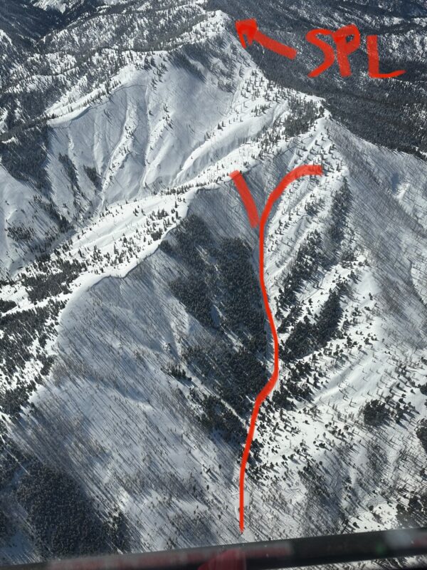
At least 6 large avalanches were observed by helicopter on March 16 in the vicinity north and northeast of Sunset Peak in two separate tributary drainages of the Crooked River, the day after a heavy storm cycle delivered over 150mm of SWE to the Boise Mountains. These avalanches are located in an area that is somewhat remote and accessed infrequently by non-motorized users because of the distance from winter trailheads, and is not often visited by motorized users.One of the largest avalanches was investigated in detail by staff from Avalanche Science on March 19 (dubbed “Magic Nose” avalanche). This avalanche is located 1.3 km north of Sunset Peak, in the unnamed drainage immediately north of the Steep Creek drainage. This avalanche has a destructive size of D4 and a size relative to path of R4-R5 (based on the SWAG, AAA 2022), and failed on a weak layer 1.1m to 1.5m deep consisting of rounded surface hoar that formed between February 22-24. Slope angles were measured at dozens of locations along the entire crown and within the upper 1/4 of the bed surface.
Signs of Unstable Snow
Observations
There have been 3 primary instability cycles this season around Mores Creek Summit (MCS), that we are aware of. Mid-December, mid-March, and April 1st. Each of these cycles included natural and skier-triggered avalanches that were D3 (mid-December and April 1st) or D4 (mid-March) in destructive size.
These observations (made on March 19) were of avalanches that are estimated to have occurred on March 15. Approximately 150mm of new SWE was deposited between March 13-15 in the MCS zone. Our helicopter photos were taken on March 16. Six separate avalanches were observed on March 16 from the helicopter, and again on March 19 from the ground.
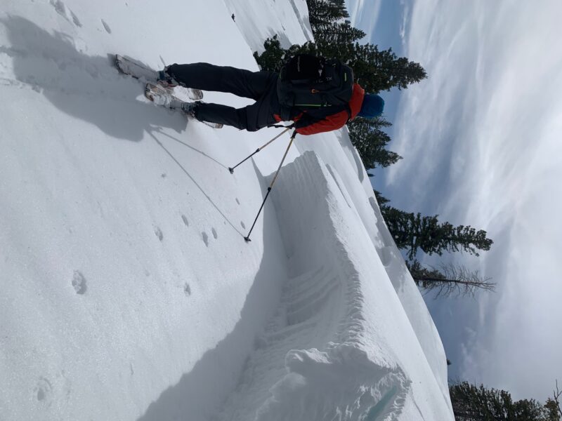
Other observations: debris piled on uphill side of trees is 1.2-3.5 m deep. In many locations at the crown, the uppermost ~1 m of the bed surface rolled over from 31 degrees to 29 degrees against the base of the crown—meaning, when the avalanche released, the slab was able to pull a small amount of additional slab from the lower angle fringe at the very top of the crown’s perimeter. Several large blocks were observed above the crown (up to 20m in size) that fractured but moved less than a half meter down slope.
PHOTOS
1. Overview, looking southwest, taken March 16. General path, plus Sunset Peak Lookout in background for reference; note equally large avalanche in background/left, northeast of Sunset Peak.
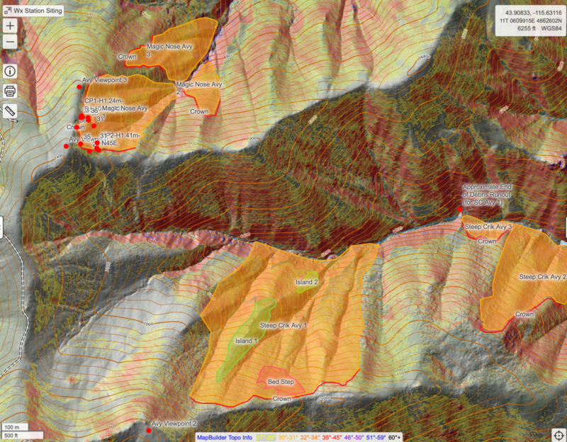
2., 3. CalTopo mapping of crown, slope angles, and 2 crown profile locations (CP1 and CP2); outline of separate avalanches observed shown in orange polygon (including ones in the Steep Creek drainage).
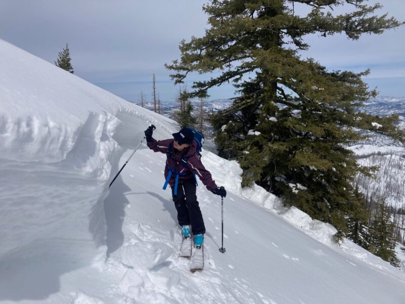
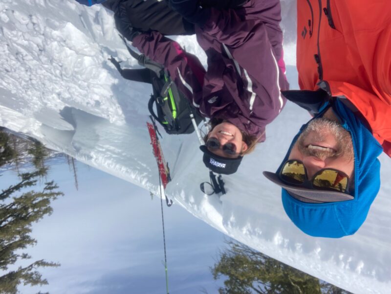
4. through 9. Photos of crown, bed surface, debris piled on uphill side of trees, slab blocks, and fractures.
10., 11. Photos of rounded surface hoar crystals, 1-2mm @ 1.24 cm depth
Media


Advanced Observations
Observed Avalanche Problem #1:
Persistent SlabComments:
Magic Nose AvalancheSize: D4/R5
Elevation: 7100 to 7300 ft at crown; 5800 ft at debris limits
Aspect: E, NE
Crown length: ~520 m
Path length: ~1,300 m
Vertical fall: 450-500 m
Slab thickness: 1.1 to 1.5 m
Weak layer: ROUNDED SURFACE HOAR (SH)
Start zone angle: 35-36 degrees
Connected terrain: 29-46 degrees (high end estimated from CalTopo)
Alpha angle: ~21 degrees