Basic Information
Observation Details
Observation Date:
December 13, 2019Submitted:
December 13, 2019Observer:
SAC - Lundy, VandenBosZone or Region:
Banner SummitLocation:
Cape Horn MountainSigns of Unstable Snow
Recent Avalanches?
YesCracking?
WidespreadCollapsing?
WidespreadSnow Stability
Stability Rating:
PoorConfidence in Rating:
HighStability Trend:
SteadyBottom Line
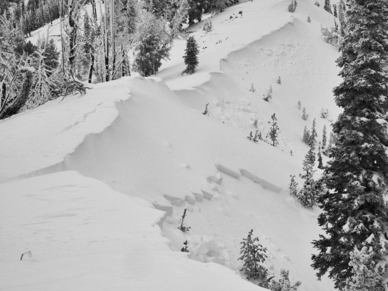
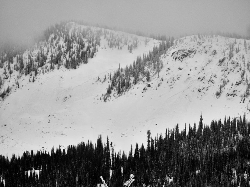
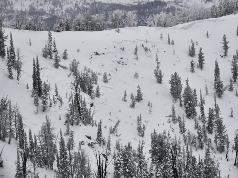
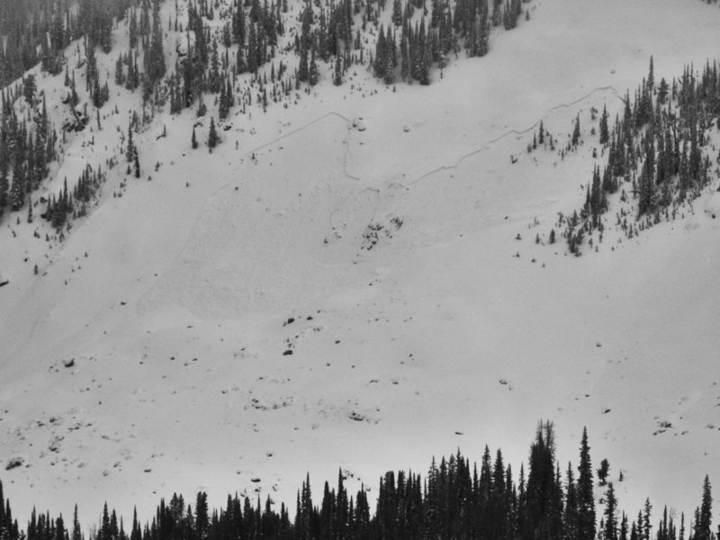
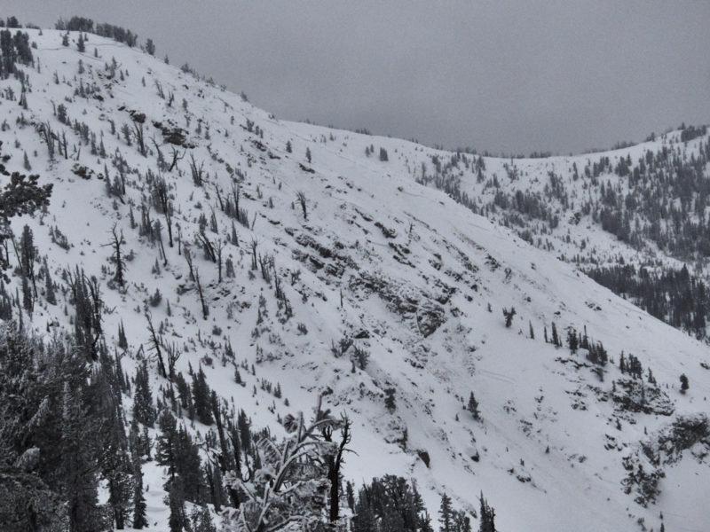
Primary weak layer in this area was 12/7 surface hoar found 16" down on all aspects at mid and upper elevations. This interface was particularly touchy on shady terrain that had seen some wind loading. As we traveled, this layer produced widespread collapsing, cracking, and numerous remotely triggered avalanches. We also observed a half dozen natural avalanches that appeared to have failed on this layer, including one very large avalanche. Very weak October facets exist on high, north slopes, but this layer was a secondary concern to the surface hoar today, but be more of a long term headache.
Media/Attachments
Advanced Information
Weather Summary
Cloud Cover:
OvercastTemperature:
low 20s F (estimated)Wind:
CalmSnowfall from the 12/11 storm was 20-25cm. Weather today was fairly benign and had little impact on the snow stability. Wind had blown consistently during the storm, creating large corncies and stiff slabs in terrain exposed to the wind. Based on snow on trees, wind had been blowing at all elevations, but was most intense at upper.
Avalanche Observations
| # | Date | Location | Size | Type | Bed Sfc | Depth | Trigger | Comments | Photo |
|---|---|---|---|---|---|---|---|---|---|
| 7 |
NE 8,600-9,100' |
D2 | SS | O-Old Snow |
AS-Skier r-Remote |
Avalanches were intentionally triggered from safe terrain on ridge lines that were not exposed to avalanche hazard. In fact, it was hard to even approach slopes without triggering slides. Most proximal slides were triggered from ~50' away. Most distal slide was triggered from ~500' away. 1 x D1, 2 x D1.5, 3 x D2, 1 x D2.5. All avalanches failed on SH buried 12/7, about 40-60cm down, depending on amount of wind loading. East through northeast aspects. | None | ||
| 5 |
N 8,700-9,300' |
D2 | SS | East through northwest aspects on the shady side of the compass. | None |
Snowpack Observations
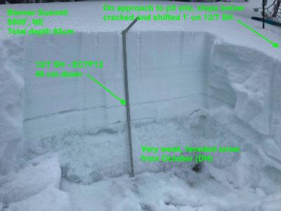
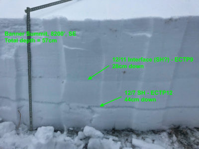
Total depth ranged from around 30-40cm at the highway to 85cm at upper elevations. 12/7 surface hoar seemed fairly widespread about 40cm down on all elevations at mid and upper elevations. Pits at 8200', SE and 8800', NE both gave ECTPs on this layer, but collapsing/cracking/remote triggering/natural activity was much more pronounced on the shady, upper elevation slopes. The October depth hoar exists on shaded slopes above about 8000-8500'. It's very well developed depth hoar, but at least where we dug, was capped by a 3-5cm MF crust that seemed to be preventing reactivity in tests. The SH layer was the primary issue and responsible for the signs of instability we observed.
Avalanche Problems
| Problem | Location | Distribution | Sensitivity | Size | Comments |
|---|---|---|---|---|---|
 Persistent Slab
|
|
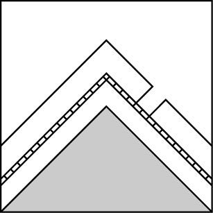
Layer Depth/Date: 40-45cm, 12/7 Comments: The problem is touchy on upper elevation, shaded slopes where cracking/collapsing was widespread and avalanches were remotely triggered and natural avalanches occurred. |
|||
 Persistent Slab
|
|
Layer Depth/Date: 11/26 Comments: 11/26 depth hoar was unreactive in stability tests, but from a structural perspective this problem deserves to be kept in the back of the mind. A pencil-hard melt-freeze crust made it difficult to stress this layer, but with a large enough load (big cornice) or an area where the facets above the crust are better developed, seeing activity on this layer is certainly possible. In places, the large natural I (Ben) observed in the Lola Creek drainage appeared to have stepped down to this layer. |
Terrain Use
Avoided avalanche terrain.
