Basic Information
Observation Details
Observation Date:
March 31, 2020 - April 1, 2020Submitted:
April 2, 2020Observer:
SAC - Lundy (off-duty)Zone or Region:
Sawtooth and Western Smoky MtnsLocation:
Williams Peak Hut areaSigns of Unstable Snow
Recent Avalanches?
YesCracking?
WidespreadCollapsing?
IsolatedSnow Stability
Stability Rating:
FairConfidence in Rating:
ModerateStability Trend:
ImprovingBottom Line
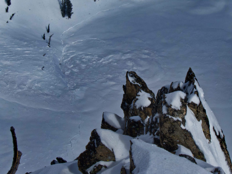
I was off-duty performing work at the Williams Peak Hut when the earthquake occurred on March 31—it was an unforgettable experience, to say the least. All of the trees started shaking and snow was falling off them. Almost immediately, a prolonged rumbling sound from widespread avalanching ensued. On April 1, we had decent visibility and climbed up the E ridge of Williams Peak to 9400' for a better look. Widespread avalanche occurred as a result of the earthquake. The combination of 2+ feet of new snow, high avalanche danger, and the earthquake led to a historic and extremely rare avalanche cycle.
Media/Attachments
Advanced Information
Weather Summary
We hiked in on the afternoon of March 31. Snowfall was nearly an inch per house all day into the evening. The settled storm total on April 1 was approximately 50cm at the hut elevation (7900') up to 60cm (2 feet) at upper elevations. April 1 began in the single digits with nearly clear skies. By the afternoon, there was more cloud cover than sun although the sun poked out occasionally. Temps remained cool and winds were light. There was some evidence of wind drifting at upper elevations, but less than expected.
Avalanche Observations
| # | Date | Location | Size | Type | Bed Sfc | Depth | Trigger | Comments | Photo |
|---|---|---|---|---|---|---|---|---|---|
| 2 |
Marshall Slide and Tortilla Slide E 9200 |
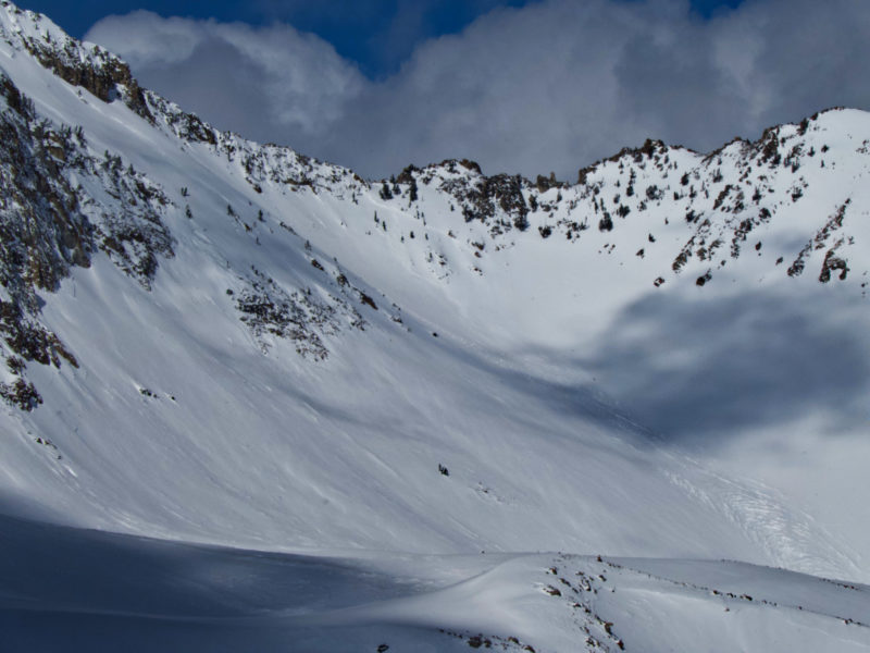
D2.5 | SS | I-New/Old Interface | 60cm | These were almost one continuous slide. Marshall Slide hit the pond in the flats near Marshall Lake. |
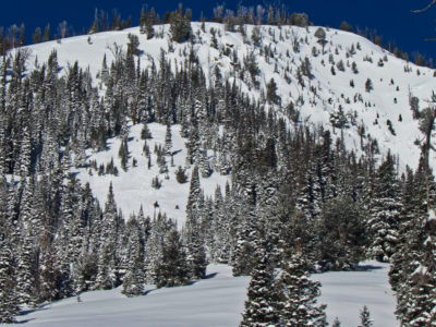
|
||
| 1 |
Bowling Alley E 8600 |
D1.5 | SS | I-New/Old Interface | 50cm | This slide hit the normal uptrack to Jerry Garcia. |
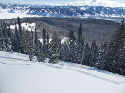
|
||
| Several |
Breakovers in the rolling terrain between upper and lower Marshall Lake E 8500-7800 |
D1.5 | SS | I-New/Old Interface | 50-60 | These look to be consistent depth with the new/old interface |
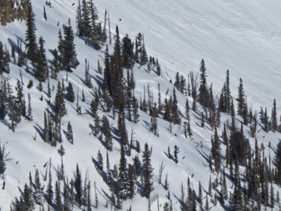
|
||
| 1 |
Yurt Slide SE 9000 |
D2 | SS | I-New/Old Interface | 50-60 |
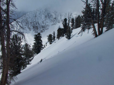
|
|||
| 1 |
|
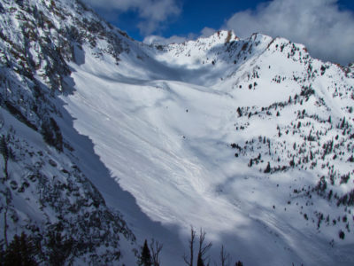
Snow that avalanched off the east ridge of Williams Peak east of Big Fatty hit Upper Marshall Lake. The lake was cracked around the perimeter, either from the avalanche impact or from the earthquake. |
|
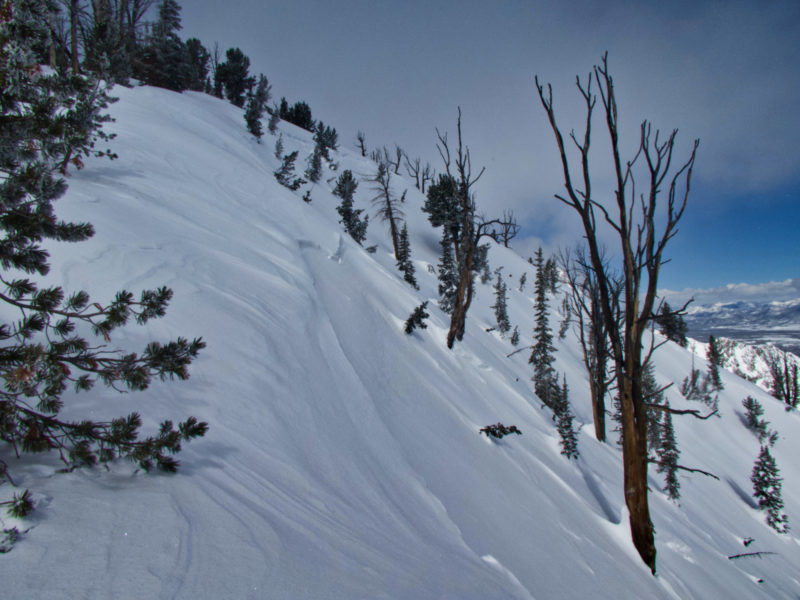
From the photos of others, it's clear that the earthquake produced an extremely widespread avalanche cycle. It's impossible to list all of the slides. Nearly every slope steeper than 40* had snow move on it in some form - whether slab, sluff, hanging snowfields releasing, etc. The slides above were the more prominent ones we observed in the terrain adjacent to Williams Peak. There were a surprising number of mid-elevation slides, especially on ~E aspects that had a crust beneath the new snow. Almost every mid-elevation slope steeper than about 37 degrees avalanched to some degree.
Most slides appeared to run at the old/new interface (a crust in many of the slides) or perhaps in the early to mid March persistent weak layers.
Snowpack Observations
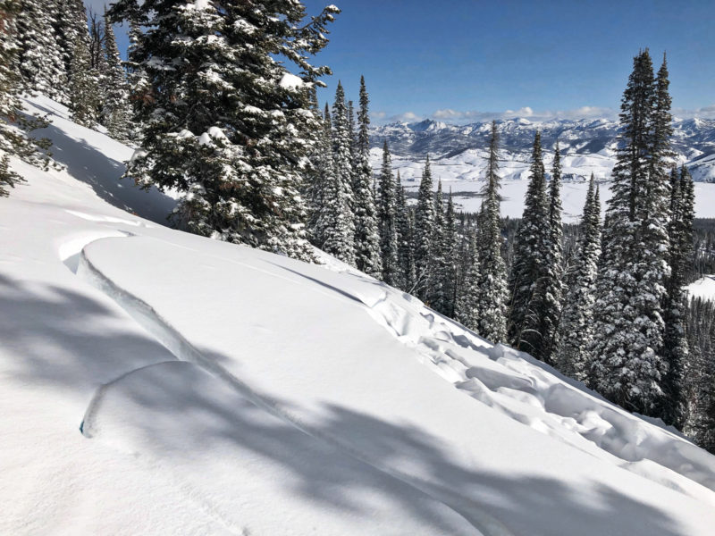
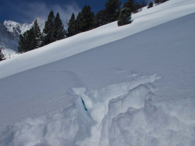
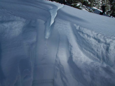
We found that the earthquake produced widespread cracking on slopes over about 25* (see photo below). Investigating these on a E aspect, it seemed the failure layer was facets below the crust at the old/new interface. Looking at a crack in the hangfire above the Bowling Alley slide, it was apparent that the slide ran at the old/new interface which was a crust. We did not see evidence that it had fractured lower than this crust. Most of the slide we observed at middle elevations seemed to consistently run at this depth.
Terrain Use
Given the large load of new snow and other red flags, we may not have felt comfortable skinning up to Jerry Garcia if the steep slope that threatens the skin track hadn't already run.
