Basic Information
Observation Details
Observation Date:
January 20, 2021Submitted:
January 20, 2021Observer:
SAC - Davis, VandenBosZone or Region:
Soldier and Wood River Valley MtnsLocation:
Shaw (S-E-N, 7,200-8,800')Signs of Unstable Snow
Recent Avalanches?
None ObservedCracking?
IsolatedCollapsing?
None ExperiencedSnow Stability
Stability Rating:
FairConfidence in Rating:
ModerateStability Trend:
SteadyBottom Line
We saw natural, persistent slab avalanches (from last week's storm) and noted repeatable unstable snowpack test scores. The primary weak layer of concern is the same layer of facets we've seen produce the vast majority of natural avalanches all across the forecast area.
While only about 15 miles to the west of Ketchum, this area possesses a deeper snowpack that's formed a stiffer slab over a better developed (weaker) layer of facets. The snowpack changes quickly as you leave the Wood River Valley. Your odds of triggering an avalanche increase in areas with this poor structure.
Media/Attachments
Advanced Information
Weather Summary
Cloud Cover:
Partly CloudyWind:
LightNew/Recent Snowfall:
1" SWE from last week's stormMild (mid-20s F), light wind, bouts of clouds and sun.
Avalanche Observations
| # | Date | Location | Size | Type | Bed Sfc | Depth | Trigger | Photos | Details |
|---|---|---|---|---|---|---|---|---|---|
| 1 |
Jan 13, 2021 (+/- 1 day) |
Rough Canyon NW 8300ft |
D2 | U-Unknown |
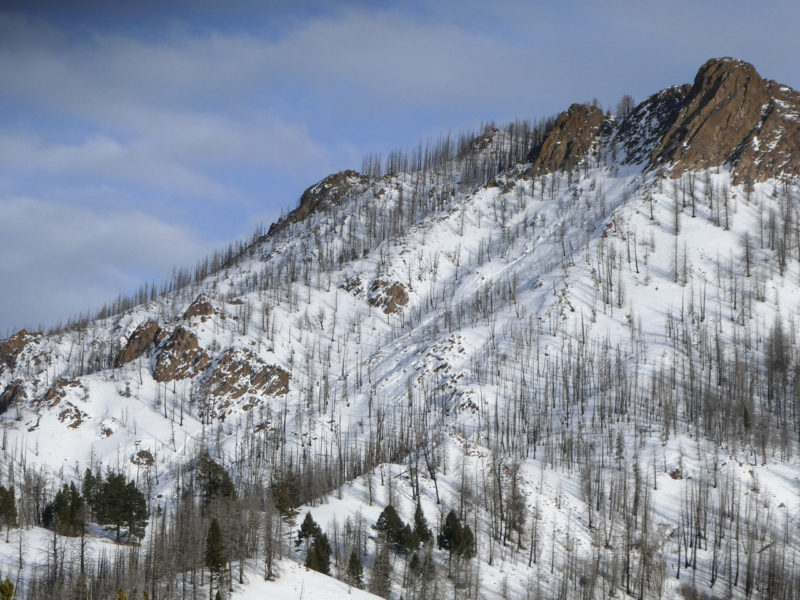
|
Report | |||
| 2 |
Jan 13, 2021 (+/- 1 day) |
Warm Springs Ck NE 8100ft |
D1.5 | U-Unknown |
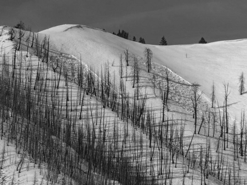
|
Report | |||
| 1 |
Jan 13, 2021 (+/- 1 day) |
Placer Creek SE 9500ft |
D2 | U-Unknown |
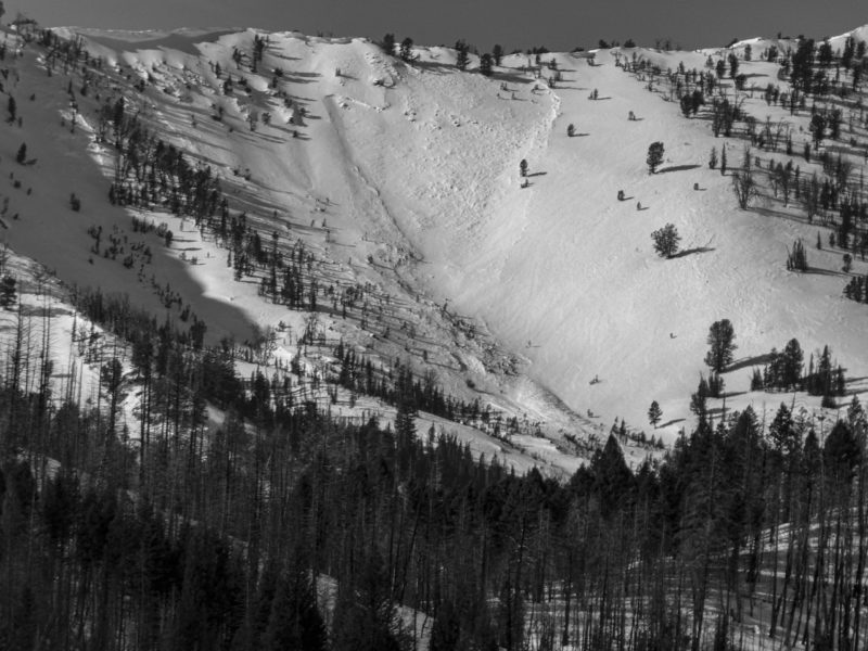
|
Report | |||
| 1 |
Jan 13, 2021 (+/- 1 day) |
Placer Creek S 9000ft |
D2 | U-Unknown |
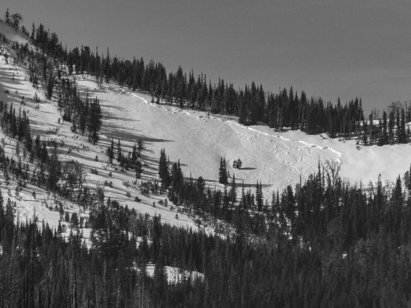
|
Report | |||
| 1 |
Jan 13, 2021 (+/- 1 day) |
Left Fork Placer Ck SE 9100ft |
D2 | SS-Soft Slab | U-Unknown |
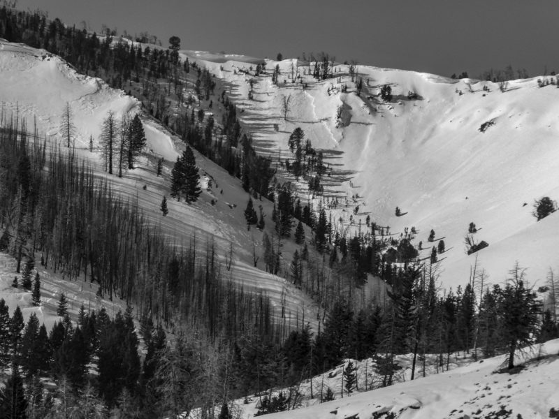
|
Report |
We also observed ~6-10 small wet snow/rain induced slides below about 7,800'.
Snowpack Observations
Approximate rain line up to 7,800' from 1/13. Crust was softening during the day on sunnier slopes. Overall poor structure with F to 4F- slab over 12/11 facets.
8,000' NE, HS=90 cm:
90-80 F-
80-55 F to F+
55 = Solstice rain crust
55-35 4F-
35-30 F- to F (12/11 facets)
30 = (11/17) crust
30-0 F
Avalanche Problems
| Problem | Location | Distribution | Sensitivity | Size | Comments |
|---|---|---|---|---|---|
 Persistent Slab
|
|
Weak Layer(s):
Dec 11, 2020 (FCsf)
Comments: Numerous CPSTs in the upper 20s, PSTs in the mid-20s, ECTPs in the upper teens. Rose is shaded where problem was observed. Natural activity and previous obs from this area suggest it's prevalent around the compass at middle and upper elevation. |
