Basic Information
Observation Details
Observation Date:
March 27, 2022Submitted:
March 27, 2022Observer:
SAC - VandenBosZone or Region:
Galena Summit and Eastern MtnsLocation:
Boundary/Casino divide (6,500-9,000')Signs of Unstable Snow
Recent Avalanches?
YesCracking?
IsolatedCollapsing?
IsolatedSnow Stability
Stability Rating:
FairConfidence in Rating:
LowStability Trend:
WorseningAdvanced Information
Weather Summary
Cloud Cover:
OvercastWind:
Light , SAn hour or two of direct sunshine this morning, then overcast skies for the remainder of the day. Light winds blowing out of the south.
Avalanche Observations
"The X" in the Sawtooths had produced another set of wet loose avalanches that overran the previous debris. These likely happened 3/25 or 3/26. The upper portion of these gouged more deeply into the snowpack than the first slide here had.
Snowpack Observations
Weakest freeze of the past week, particularly above the level of the inversion (~7,500' or so). Here, the surface crust was 6-8cm thick and was easily punched through with a pole handle. Little direct sunshine slowed the crust breakdown a bit, but very warm ambient temperatures were creating trapdoor breakable conditions by noon on any slope that hadn't previously been thoroughly cooked by the sun. W/SW provided good corn skiing around noon, thanks to a bit more cooked snowpack underneath, but these were on their way to becoming trapdoor skiing as well.
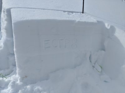
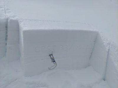
I dug on N at 8,700' to check in on upper snowpack weak layers and see how much water was moving through the snowpack on shaded aspects. Here, melt-water had penetrated around 40-50cm into the snowpack. Based on my observations the previous day I suspect that most or all of this happened in the previous 24 hours. Both 3/8 and 1/20 were moist. I received ETCP 8, 13, and 14 on 1/20, down 35cm. I also received CPST 31 and 34/100 END on this interface. These scores were very similar or even a bit worse to my previous pit at this location on 3/21. I don't think we are out of the woods on these layers yet, particularly as we pump more meltwater down there. I think I'll start to feel somewhat better about them when we actually start to freeze the snowpack again.


Avalanche Problems
I avoided avalanche problems by avoiding avalanche terrain, though wet snow problems (both loose and slab) would've been my primary concerns, depending on aspect and elevation.
Terrain Use
I avoided avalanche terrain.
