Basic Information
Observation Details
Observation Date:
January 15, 2023Submitted:
January 15, 2023Observer:
SAC - Scott Savage (OFF DUTY/REC DAY)Zone or Region:
Sawtooth and Western Smoky MtnsLocation:
Beaver Ck (7200-9000': W-NW-N-NE-E-SE)Signs of Unstable Snow
Recent Avalanches?
None ObservedCracking?
None ExperiencedCollapsing?
None ExperiencedBottom Line
We didn't experience any significant collapsing or cracking, and we traveled predominantly in terrain that sees no traffic. I was a little surprised we did not experience any collapsing on/near the wind-affected ridgelines where we traveled. Visibility was marginal, but we did not see any recent natural avalanches. There was some significant recent wind-loading on isolated W-NW-N-NE aspects above about 8500'.
Advanced Information
Weather Summary
Cloud Cover:
OvercastTemperature:
20s F and droppingWind:
LightNew/Recent Snowfall:
HST=10-18" (25-45cm) from recent storms, depending on elevation (since either 1/5 or 1/8, hard to tell) HN24=2-3" (5-8cm)Skies ranged from broken to obscured with a trace of snowfall/graupel mid-afternoon. There was valley fog this morning and intermittent low-level clouds (below 10000') throughout the day. There was evidence of previous wind loading from E-SE-S winds. There was no active wind loading today. There is a moderate amount of snow available for transport.
Snowpack Observations
HS=100-130cm below 8000', 60-90cm on winded, upper elevation SE slopes, 160-180cm on shady slopes 8500-9000'
No formal pits: only probing, pole pits, and hand pits.
There was 10-18" (25-45cm) above the 1/5-1/8 layer(s), increasing with elevation. There was a crust associated with 1/5 or 1/8 on most slopes where we traveled, although it was very subtle on shady slopes above about 8500'. The upper snowpack crusts (formed Jan 11-14) petered out on shady slopes around 8000' but were present on W and SE a little higher in elevation.
Lower elevations: There are some crusts+FC interfaces in the upper snowpack that are worth watching before the next decent loading event.
Upper elevation SE: On very exposed, winded slopes, the snowpack was 60-90cm and comprised of crusts, FC, mixed forms, melt forms, and some rounds. It looked more like the snowpack in the Hailey-Ketchum corridor - ugly structure but needs a fresh loading event to be a significant problem.
Middle and upper elevation shady: In sheltered terrain, probing and pole probing indicated the snowpack is generally well-graded. I did not perform any snowpack tests on the 1/5 PWL, but it was fairly obvious (medicore to poor structure: FC and some SH shards visible with the naked eye).
Avalanche Problems
| Problem | Location | Distribution | Sensitivity | Size | Comments |
|---|---|---|---|---|---|
 Persistent Slab
|
|
Unknown |
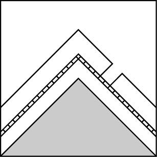
Layer Depth/Date: 25-45cm Weak Layer(s): Jan 5, 2023 (SH) Comments: Shaded area indicates where we traveled. We observed poor structure (SH, FC, or crusts+FC) in the 1/5 layer. The layer looks worst on shady slopes above about 8300', thus the "Specific" Distribution. |
||
 Wind Slab
|
|
Layer Depth/Date: 20-45cm Comments: Shaded area indicates where we saw significant wind deposited snow: at/near ridgelines and cross loading on the sides of chutes and gullies. The smaller wind slabs we encountered were stubborn, but I can't speak to the larger wind features - I would not have wanted to tangle with them. |
Terrain Use
We planned to keep it simple and avoid avalanche starting zones and tracks.

