Basic Information
Observation Details
Observation Date:
February 22, 2023Submitted:
February 22, 2023Observer:
SAC - Lundy, DavisZone or Region:
Sawtooth and Western Smoky MtnsLocation:
Iron/Goat Divide (6500-9100', SE-E-N-NW)Signs of Unstable Snow
Recent Avalanches?
YesCracking?
IsolatedCollapsing?
None ExperiencedSnow Stability
Stability Rating:
GoodConfidence in Rating:
HighStability Trend:
SteadyBottom Line
The recent storm dropped 4-6 inches of new snow in this area which did not appreciably change the snow stability on slopes that haven't been wind loaded. In sheltered terrain, we found a variable, messy mix of crusts and facets on sunny aspects and a simpler layer of weak facets on shady slopes. The weakest snow was ~10" down and there currently isn't enough of a slab to be an issue.
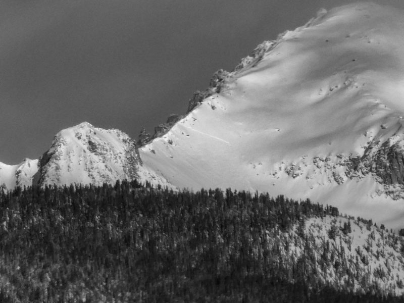
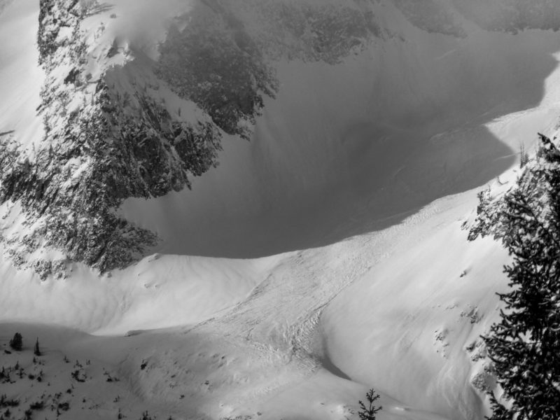
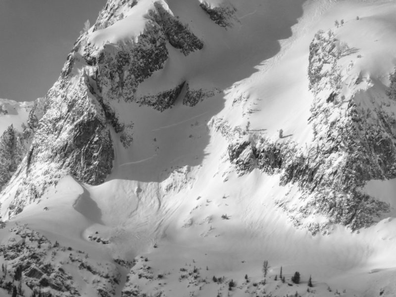
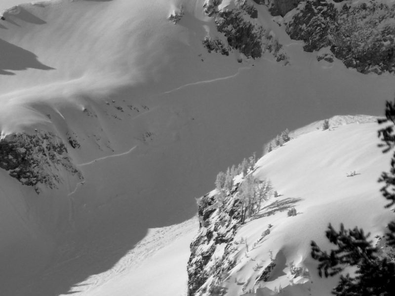
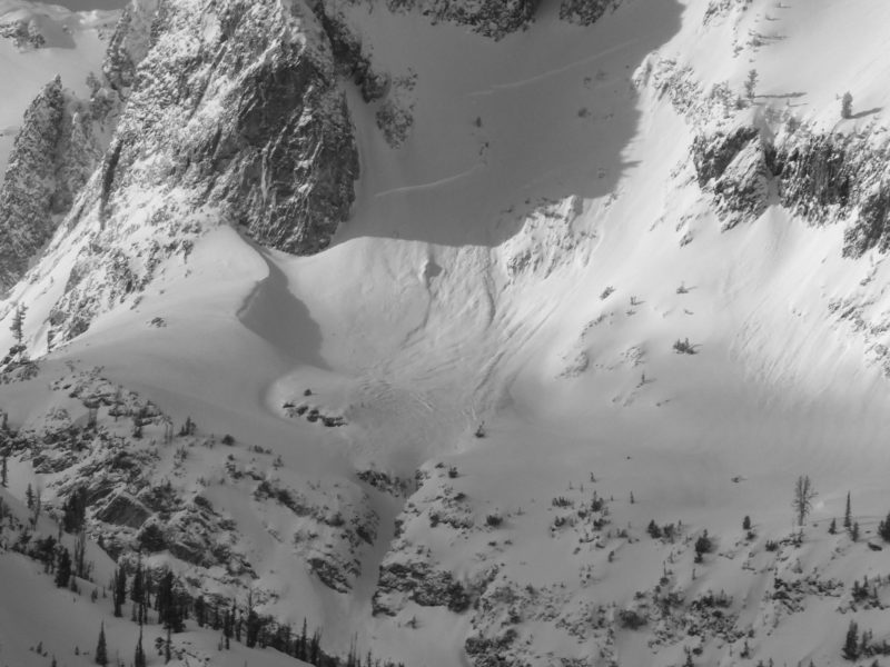
While we did not observe a wind slab problem at middle elevations, a number of natural avalanches occurred in wind-loaded, upper elevation and alpine terrain.
Advanced Information
Weather Summary
Cloud Cover:
Mostly CloudyWind:
Light , NWNew/Recent Snowfall:
HN from 2/18 seemed to be 10-15cm at middle elevationsScattered clouds this morning increased through the day, becoming overcast by afternoon. We had periods of S-1 in the afternoon with only trace accumulation. Cold temps and no solar gain.
Avalanche Observations
| # | Date | Location | Size | Type | Bed Sfc | Depth | Trigger | Photos | Details |
|---|---|---|---|---|---|---|---|---|---|
| 1 |
Feb 21, 2023 (+/- 1 day) |
Parks Pk SE 10100ft |
D2.5 | N-Natural |
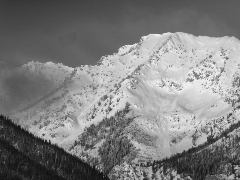
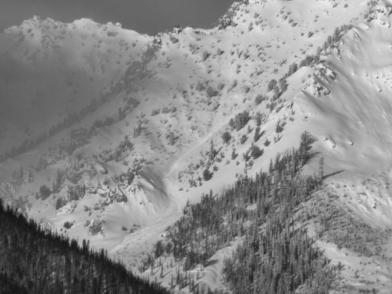
|
Report | |||
| 1 |
Feb 21, 2023 (+/- 1 day) |
Parks Pk E 10100ft |
D3 | N-Natural |
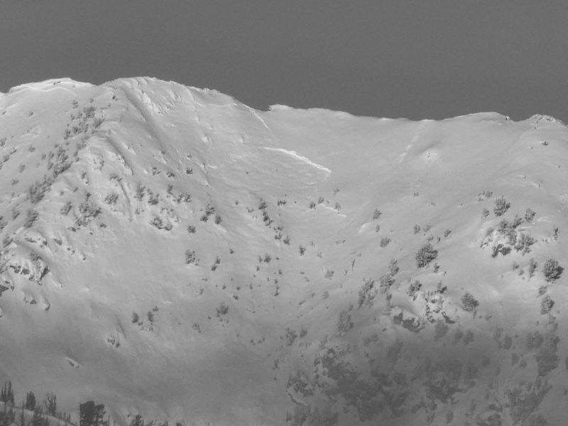
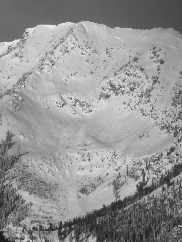

|
Report | |||
| 1 |
Feb 21, 2023 (+/- 1 day) |
Decker Pk E 10100ft |
D2 | N-Natural |
|
Report | |||
| 1 |
Feb 21, 2023 (+/- 1 day) |
Merritt Pk E 9600ft |
D2 | SS-Soft Slab | N-Natural |
|
Report | ||
| 1 |
Feb 21, 2023 (+/- 1 day) |
Merritt Pk N 10000ft |
D2.5 | SS-Soft Slab | N-Natural |
|
Report |
This storm seems to have produced more avalanche activity (in upper elevation, wind loaded terrain) than the last storm. Hard to say why - maybe yesterday's brief periods of intense snowfall coincided with strong NW winds?
Snowpack Observations
Low elevation snowpack consists of 5-7cm of HN on a thin melt-freeze crust over a thick pile of facets.
Above about 8500' we began to see a thin crust at the base of the 2/18 storm. It could have been a rime crust, but felt more like a rain or mist crust. We did not observe it down lower. Perhaps it was from a low, moist cloud that sat on the mountains early in the storm? It was barely perceptible while skiing and felt less pronounced than what Ben observed on Copper on 2/18.
@8500', ESE: HS 150cm. We found variable crust/facets layers in the upper 30cm. In a short span of distance, we went from seeing a crust/facet/crust sandwich to this welded into a single 2-3cm thick crust a few feet away. In either scenario, very weak facets exist below these crusts which produced ECTP17, ECTN14 down 27cm. ECTN3, 9 down 11cm on the rain/rime crust.
@8650, NW: HS 145cm. Sheltered location. Upper snowpack was much simpler, with the 2/13 and 2/18 storms sitting atop a 5cm thick layer of weak facets (down 22cm) - ECTN14, 17. ECTN14x2 on the 2/18 interface down 15cm. Bottom 7-8cm of "slab" is close to 4F but the rest is F.
Avalanche Problems
We did not observe any avalanche problems in the low and mid elevation terrain we traveled through. Although we ascended a wind exposed ridge that is often loaded, the wind slabs we did see were very small and unreactive. Avalanche activity observed in upper elevation/alpine terrain indicates a likely wind slab problem up high.
Terrain Use
In our trip plan, we closed wind loaded terrain steeper than 35 degrees. We felt comfortable skiing sheltered terrain in the mid to upper 30s.

