Observation Details
Observation Date:
December 16, 2019Submitted:
December 18, 2019Zone or Region:
Galena Summit and Eastern MtnsActivity:
DrivingLocation:
Galena Summit on highway 75Signs of Unstable Snow
None reported
Observations
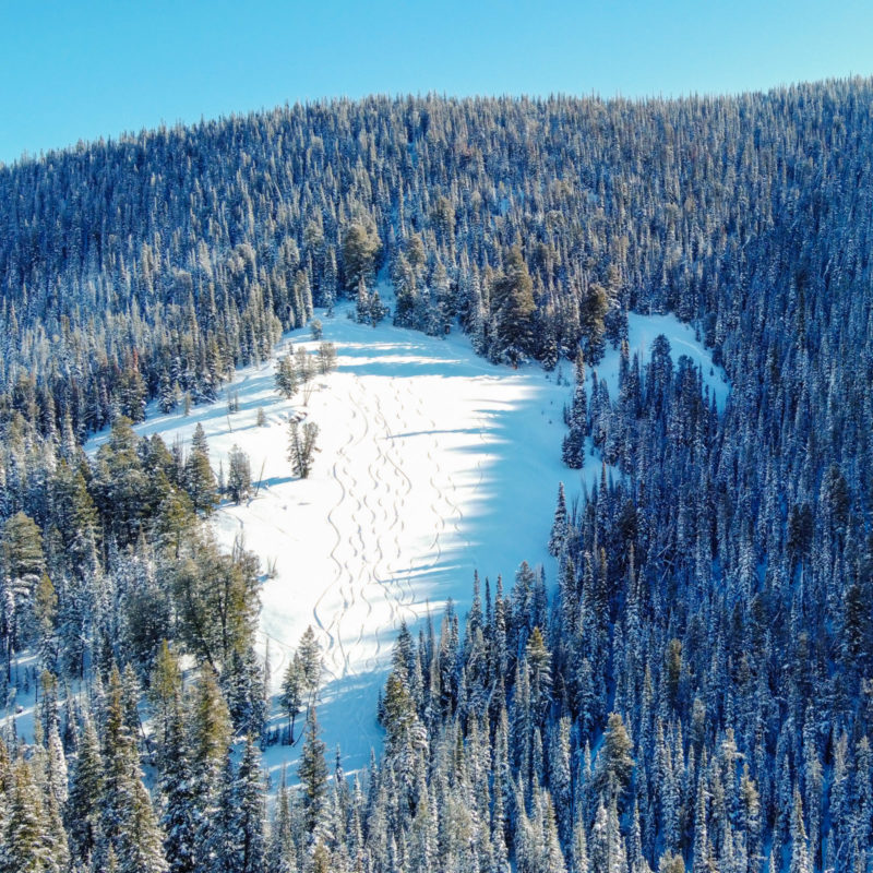
This drone aerial photo was taken on the shoulder of Rt 75 as I was headed toward Ketchum on the Stanley side of Galena Summit. It looks to the right at slopes approximately beneath the Titus Ridge trail. Note the ski tracks down the center of the photo. More importantly, note the ski tracks that head right through the shaded area of the upper part of the main slope (above and below the island of trees). These tracks head toward the smaller open slope in the upper right corner of the photo. There, you can see the crown of a slab avalanche.
Media

